Software built to connect the office to the field
Solutions designed to connect the office to the field across the lifecycle of heavy civil and infrastructure projects in one product suite.
Schedule a demo
Bid management
An estimate management and project-tracking solution for construction estimating teams that need a simple, intuitive way to manage prospective and upcoming work.
Learn more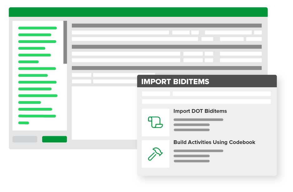
Estimating & bidding
Get ahead of the competition with a standardized estimating process built to bid faster and more accurately to win more jobs at the right margins.
Learn more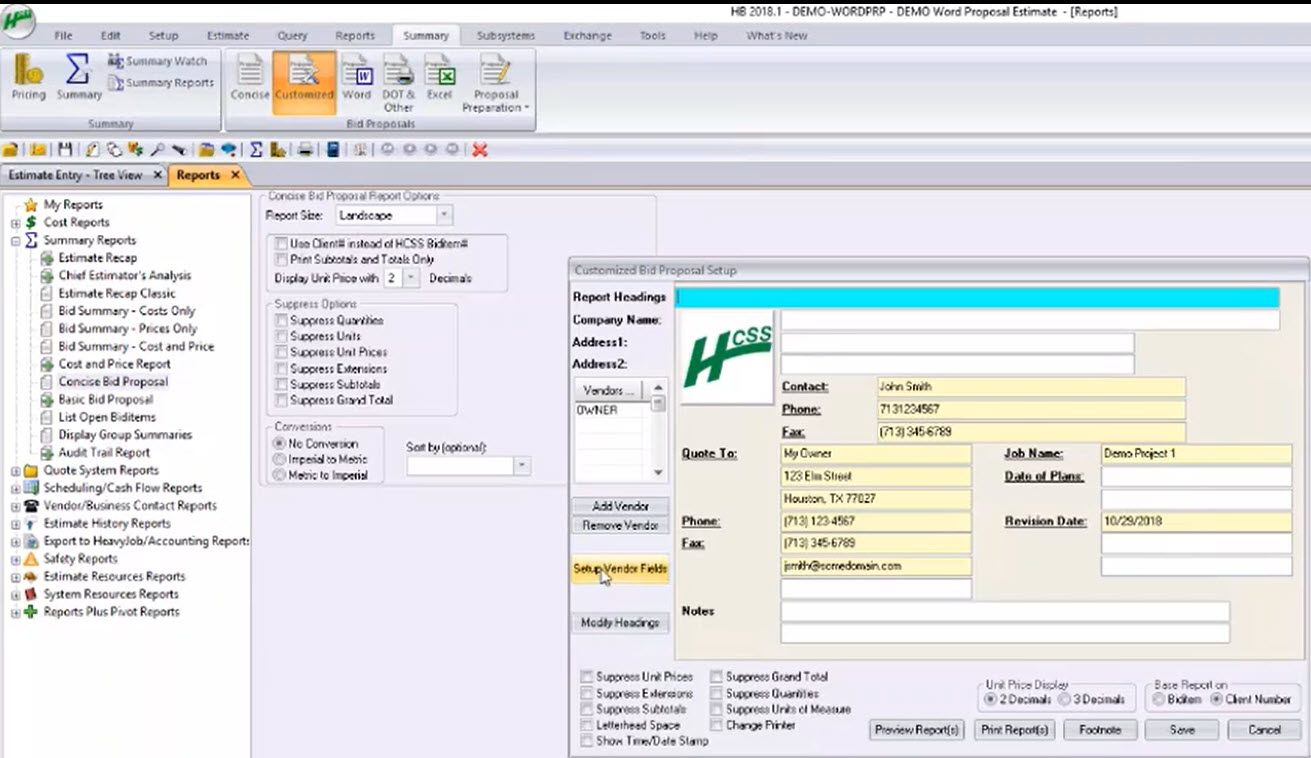
Proposals
Produce accurate proposals in a professional appearance quickly and in the format that the owner requires.
Learn more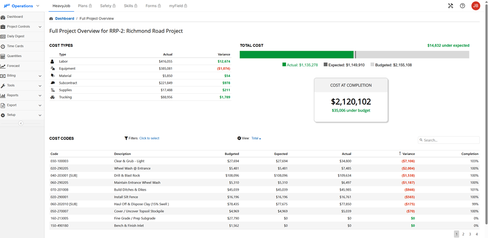
Job costing
Know how your jobs are performing in one quick glance on an easy-to-read dashboard.
Learn more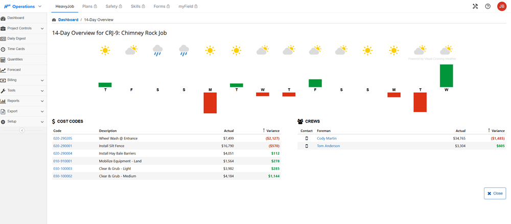
Project management
Capture time cards, site conditions, photos, and job progress to give project managers and executives insight into every project.
Learn more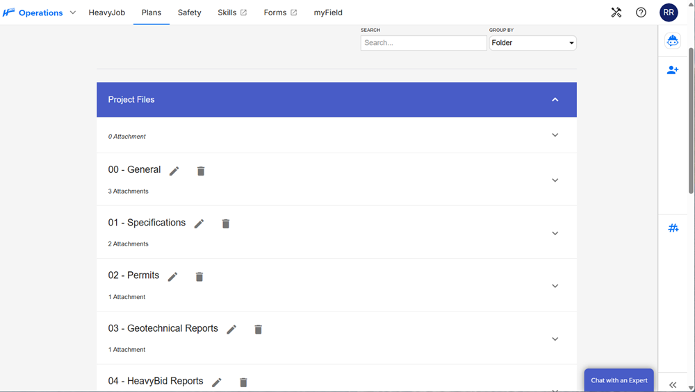
Digital plans
Avoid costly rework and project delays by using real-time version control, notifications, and automatic syncing to deliver the latest plan sets directly to your device.
Learn more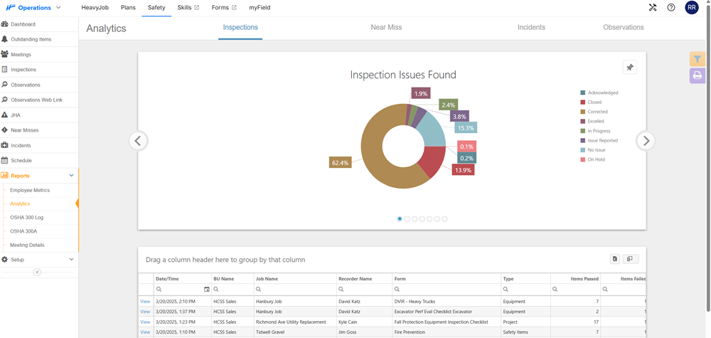
Crew safety
Make it easy for crews to participate in your safety program, get alerted to compliance gaps, and spend more time managing risk.
Learn more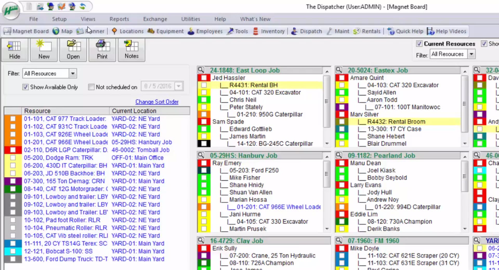
Schedule & dispatch
This digital scheduler represents your magnet board and allows your dispatcher to manage crews, equipment, materials, rentals, tools, and more.
Learn moreTime tracking
Enhance labor costing and operations processes by empowering your teams to log their daily shifts and tasks individually.
Learn more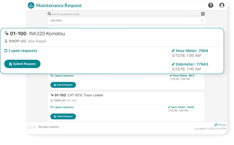
Equipment maintenance
Use real-time data to monitor heavy equipment status, maintenance needs, usage, and overall performance.
Learn more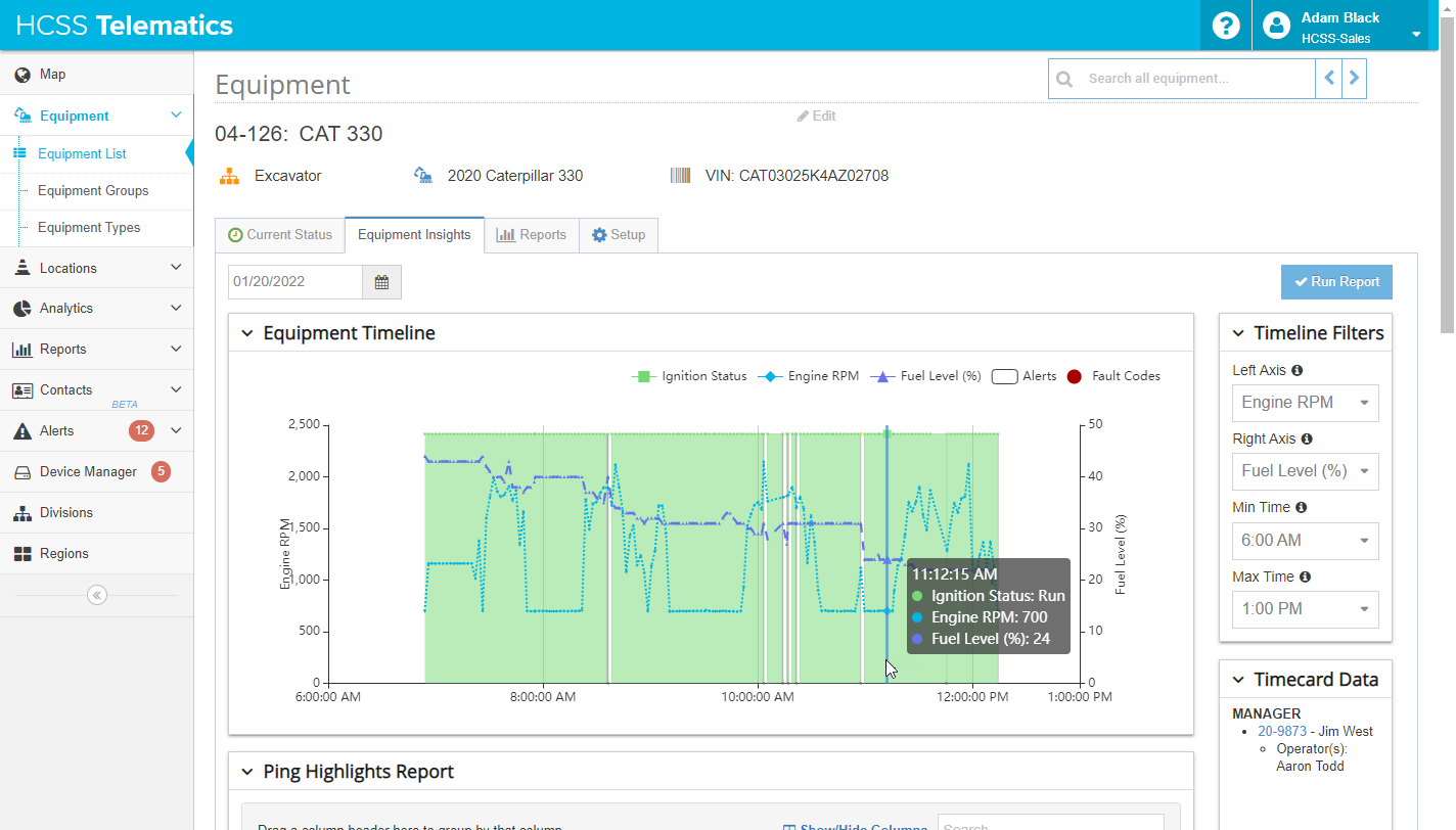
Asset tracking
Get real-time alerts straight from your equipment to keep your fleet healthy and profitable year-round.
Learn more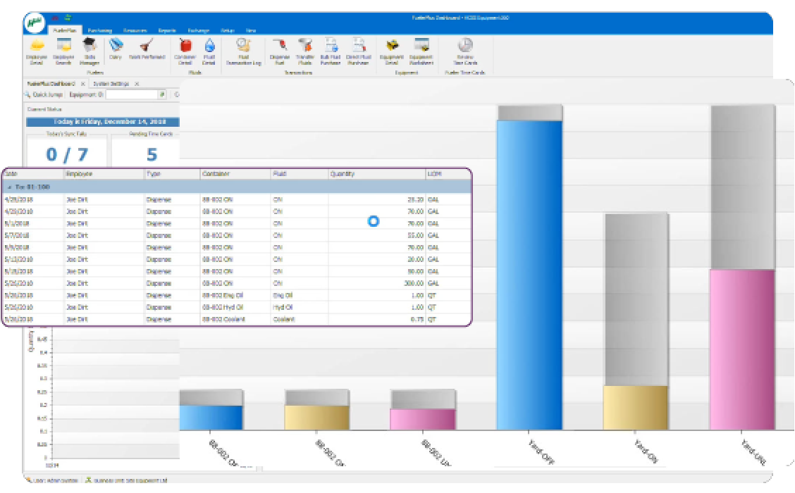
Fuel management
From fuel dispenses and purchases to actual fuel burn rates, use real-time data to help you decide how to recoup costs from operations.
Learn more
Cloud hosting
We host your HCSS software and data on our highly secure servers, managing all technical aspects behind the scenes.
Learn more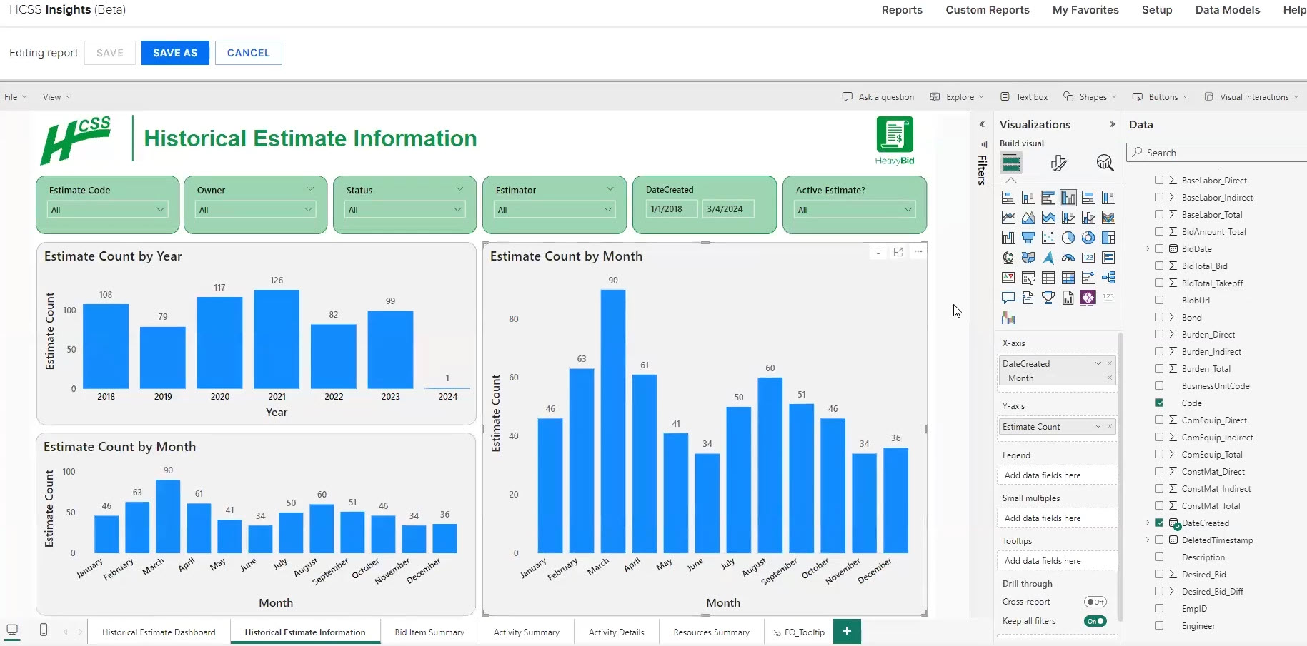
Reporting
Access automated and customized reports powered by Microsoft Power BI that support data-driven business decisions ensure your company can quickly learn from past jobs, and inform future decisions with up-to-date data.
Learn more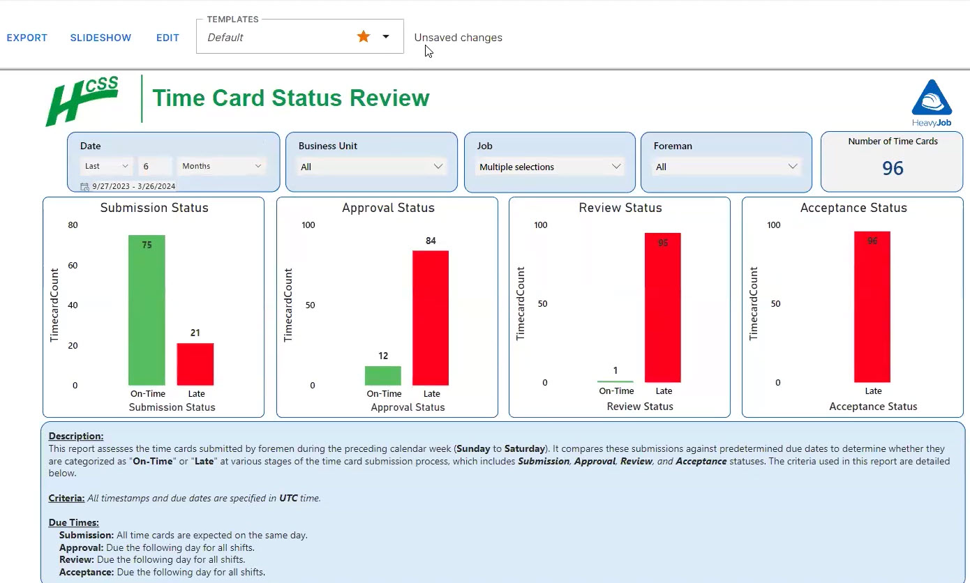
APIs
Integrate your apps with HCSS software to auto-sync your accounting system, create custom reports, build your own apps, and more.
Learn moreBuild smarter, faster, and safer with the #1 software in heavy civil construction
- Connect your workflows — From estimating to job tracking to equipment management
- Make data-driven decisions — Real-time insights across your projects and teams
- Scale confidently — Trusted by firms of all sizes, with support available 24/7